The climate is changing, and that means that our natural areas, such as parks and preserves, are reaching higher temperatures in the summer and getting colder in the winter. National parks have reportedly seen more deaths than usual this summer thanks to extreme heat. Changing weather patterns means some areas are seeing devastating storms, wildfires, and other natural disasters. All of these changes could mean trail closures throughout the year that could affect your hiking plans — and some areas are seeing that already. The summer months bring a lot of challenges to hikers who are not ready for the nuances of climate.
Some trail closures happen regularly, such as in areas that see a lot of rain in the summer months or that get a lot of snow in the spring. Other closures may come as a surprise because of longer-term events, such as indefinite closures to accommodate endangered or protected species. It’s a good idea to keep up with conditions on trails you may be visiting.
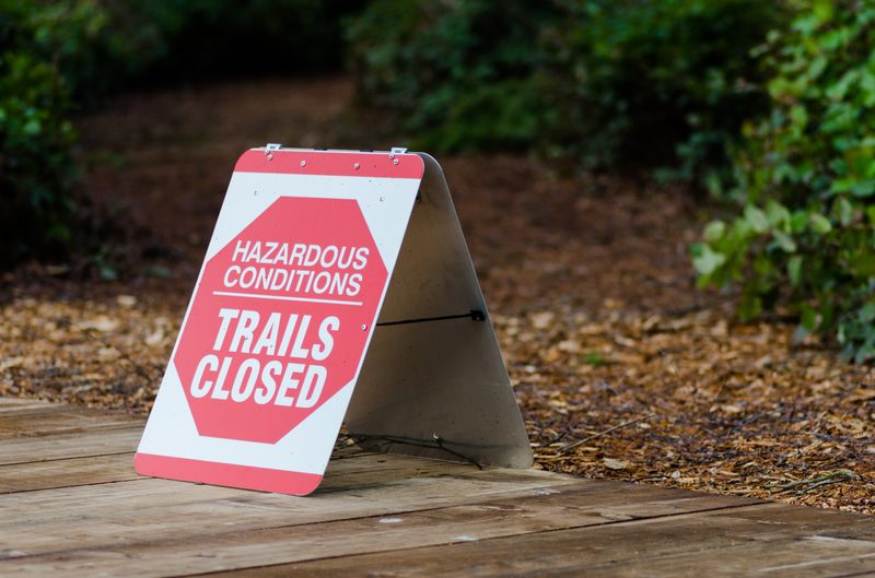
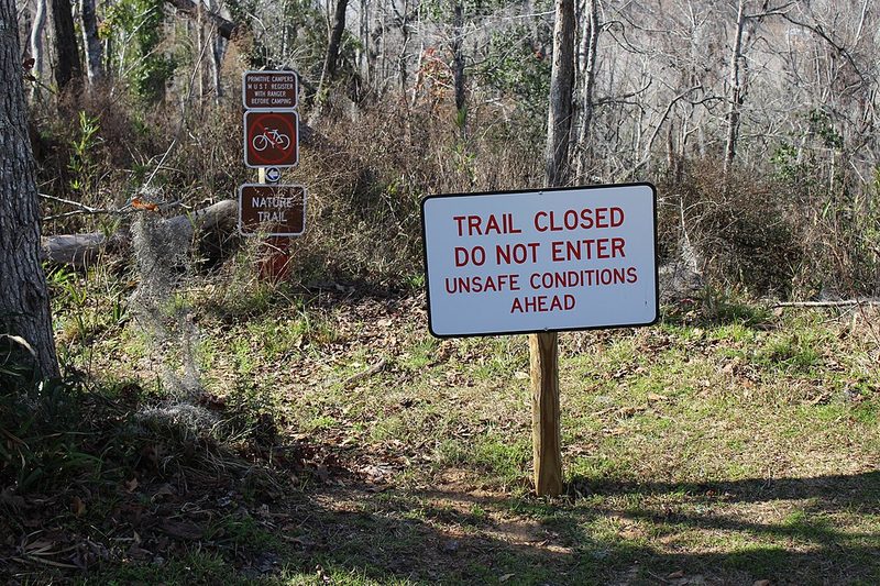
Common reasons for closure
With hot areas getting hotter and cold areas getting colder, the climate brings hazards to the trail that may be unique to their location. Some weather conditions build upon one another, such as a climate that is hot and humid resulting in heavy rains that could, in turn, cause flooding. Wildlife, both flora and fauna, might also close a trail, and human activity is not exempt.
Snow
Most people associate snow with winter, but the highest altitudes could be snow-capped year-round. Late-season snow could cause trails and trailheads to be closed by blocking access to these routes and necessitating detours. What might have been a 14-mile trek on a point-to-point trail could suddenly become a 22-mile adventure because of snow blocking a road or entrance. Plus, snow eventually melts.
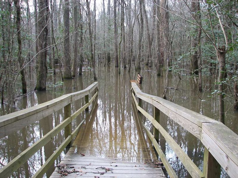
Flooding
Flooding might be caused one of two ways – either snow on a trail has melted and caused runoff, or there have been heavy rains in the area. Such flooding affected residential areas of Santa Barbara in March 2023 and may have contributed to the death of actor and experienced backpacker Julian Sands as heavy rains inundated Mount Baldy. Meanwhile, late-season snowfall in Zion National Park in May 2023 caused The Narrows, a popular destination for outdoorsmen, to flood in June as the snow melted.
Flooding is especially dangerous for hikers because runoff can have a strong current that washes away anything in its path that can move. Flash flooding is even worse because it can happen with little warning, even if the source of the water is miles away from the flooding site.
Trail erosion
There are numerous causes for trail erosion, including rain and flooding, wildlife activity, and human interference. If trail conditions are deteriorating to the point where a trail is dangerous because of erosion, park services will shut it down. This might be because of falling rocks, excessive flooding, or animal trails causing a danger to humans.
Humans themselves could cause danger on trails. Human activity, such as carving into rocks and trees or building piles of stones known as cairns, violates the “Leave No Trace” mission of the U.S. National Park system and can be a major cause of trail erosion. When out hiking or backpacking, it is incumbent upon every hiker to respect the trail so it can be there for future generations.
Trail erosion may be temporary or permanent. Sometimes a trail can be restored for human use after impact studies and rehabilitation of the environment. It is a lucky thing when a trail can be reclaimed in this way, as well as a reminder of the delicacy of nature.
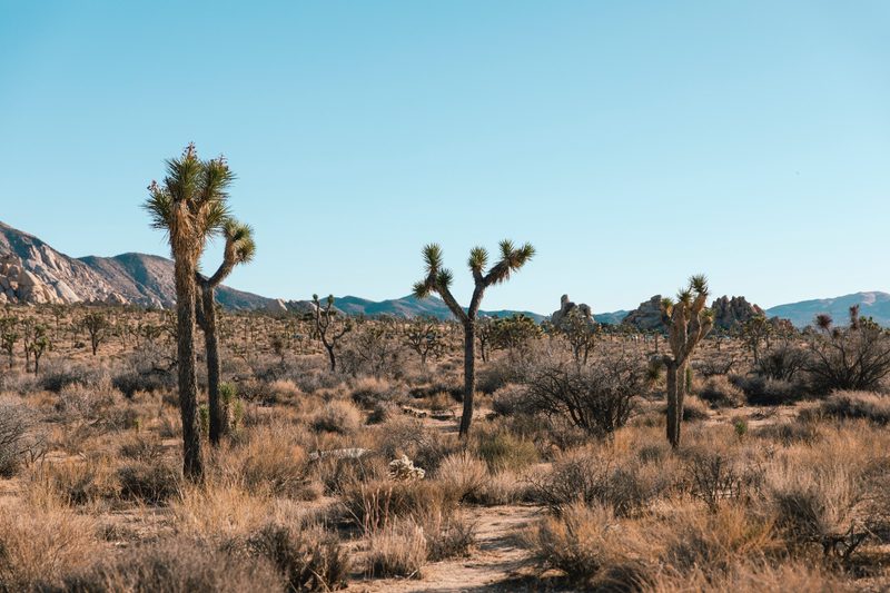
Excessive heat
Some trails are located in the desert, while others are in places that are very humid. Trails like these can be very hot during the summer and even throughout the year. Sometimes hikers wind up dehydrated or heat exhausted on a trail whose heat they weren’t expecting. While bringing enough water is an important part of trekking in the wilderness, a trail that is closed because it’s too hot out is a trail that can cause hikers heat exhaustion even if they have plenty of water.
Protecting endangered species
Not every trail closure is a negative. The outdoors is the natural habitat of every species, including those whose numbers are dwindling. They migrate or settle through parks and preserves, causing trail closures when human presence is disruptive to a species.
Adding new trails
In order to expand the activities outdoorsmen can participate in, some parks are adding new trails to their networks. Since this activity requires environmental impact studies, planning, and some construction, the addition of a new trail might cause the closure of the existing destination. Closures like this are temporary but may last months or years, depending on the scale and difficulty of the expansion.

Where to find trail information
The best place to find out about the conditions of a trail is online. Trails that are located in national, state, or county parks will usually be listed on the park’s website, along with any requirements to hike the trail, such as permitting or licensing. Trail closures are almost always listed at the top of the page, as well as in the park’s “news” section. There are also apps sponsored by national and state parks that provide up-to-date information right to your smartphone.
Some trails, including the longer national adventures like the Appalachian or Pacific Crest, have websites dedicated to the entire trail, which may span multiple states. These are kept up by experienced hikers that are in communication with the parks and can provide closure information to hikers planning their visits. Each state may also have a hiking group of its own that serves as a forum for information and finding groups to hike with.
Even if you don’t think there will be any closures at a trail you plan on visiting, check anyway. It’s better to know in advance than to be surprised when you reach the trail.


