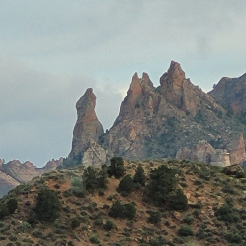
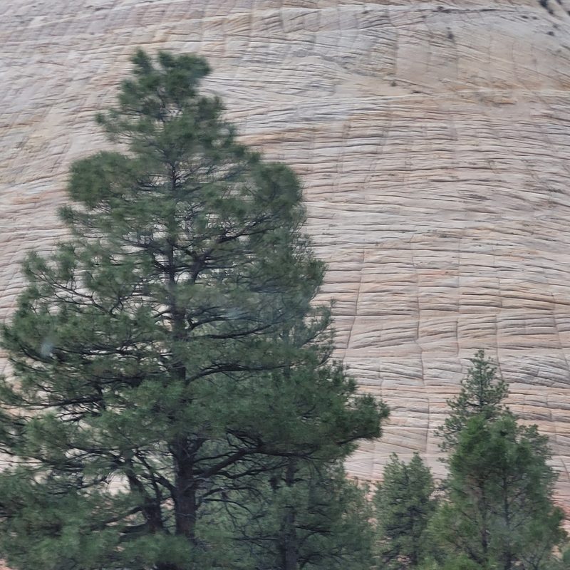
Utah is known for majestic, almost otherworldly scenery that includes such renowned sites as Delicate Arch, Bryce Canyon, and Goblin Valley. Much of the state offers picturesque vistas with mountains, canyons, and unique rock formations that are known worldwide. There are a lot of national parks in Utah, which means there are numerous places to hike, backpack, and play outside in the wilderness.
Tucked away in Southwestern Utah is the Greater Zion region, which holds a variety of wonders to explore for outdoorsmen of all levels. The area is also home of the Zion National Park, a wonderland of gorgeous vistas overlooking the Virgin River, which runs through a canyon of Utah’s distinctive red rock.
So what makes the Greater Zion area one of the best places to visit in Utah?
St. George, Hurricane, and Springdale
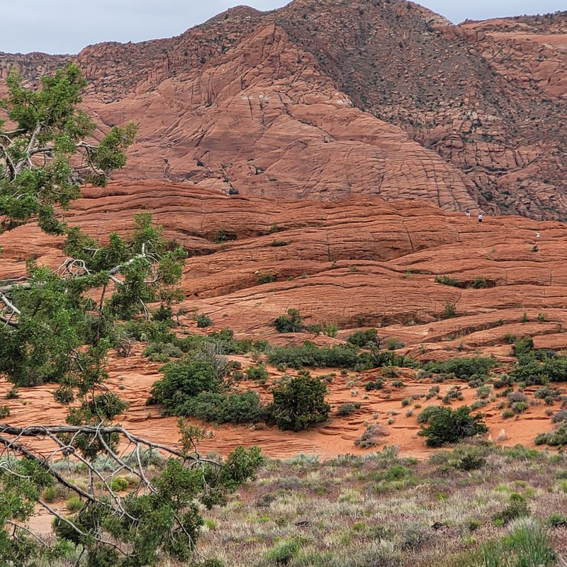
The small city of St. George has its own airport, but it has only three gates. Those looking to explore Greater Zion will fly to this airport from Salt Lake City or Denver. Almost immediately, visitors are treated to amazing views and numerous outdoor areas, including Jenny Canyon, Red Cliffs National Conservation Area, and Snow Canyon State Park.
As you drive closer to Zion National Park from St. George, you would pass through the town of Hurricane, which has some great restaurants and “glamping” grounds, where you can acclimate to the altitude before setting out on the trail. Springdale is located right at the entrance of the park and has a shuttle bus that runs to and from the visitor’s center. This little town also has quaint hotels, fine dining, and plenty of gift shops.
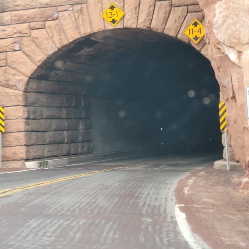
Highway 9 and Zion-Mount Carmel Highway
Driving down the road can be as exciting as hiking in Greater Zion. Highway 9 brings visitors to Springdale, and then continues through the mountains on a road that is an incredible feat of engineering. The Zion-Mount Carmel Highway travels through some of the most scenic parts of Zion National Park, as well as some of its trailheads, such as the East Rim Trail. It has its own unique sites, particularly the Zion-Mount Carmel Tunnel, which was built in the 1920s.
Zion Canyon Scenic Drive
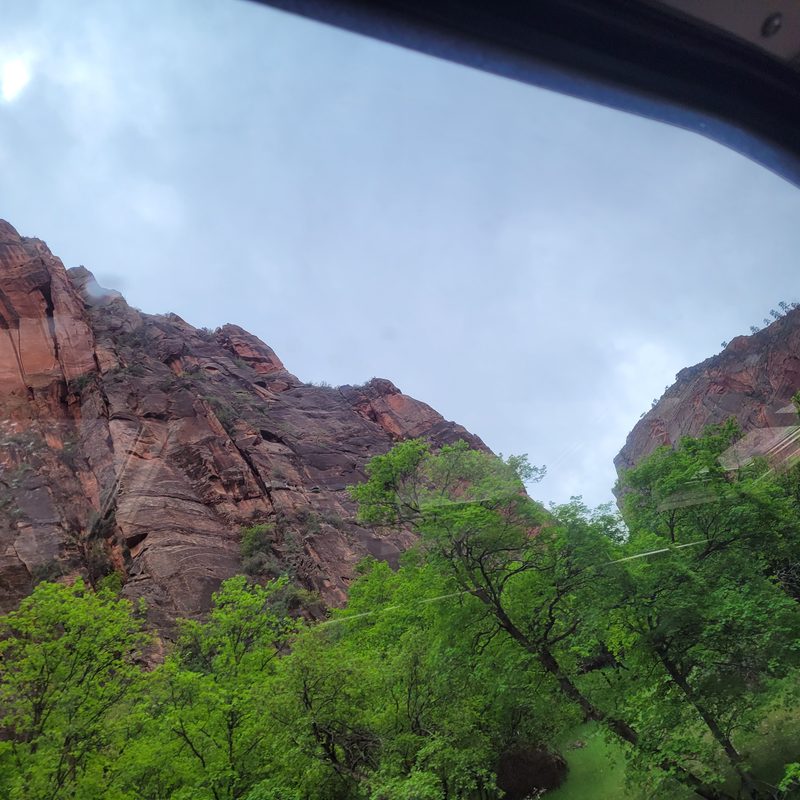
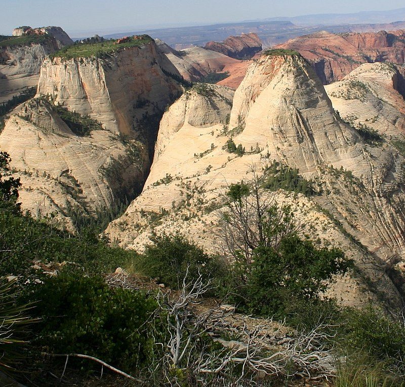
Zion National Park is a massive place, with a central thoroughfare that is a 9-mile road. You can hike or bike on this scenic drive, but only the park’s shuttle buses are allowed to drive its length for most of the year. (If you’re visiting in the winter, however, you can take in the drive in your own vehicle.) The shuttle has nine stops along its route, including the Court of the Patriarchs, The Grotto, and the Temple of Sinawava, and most of the park’s trails are connected to this road in some way. Since riders will be doing a lot of looking up, the shuttle buses have windows in the roofs in addition to its tall side windows to enable the best views possible.
The East Rim Trail
There are trails on either side of the canyon surrounding the Virgin River. The East Rim Trail is 11 miles that begins at Checkerboard Mesa, a rock formation unique to the Zion area. Although it is considered a challenging trail for hikers, it’s worth it for those picturesque views everyone has seen on Instagram of Observation Point.
The West Rim Trail
You can access the west side of the park from the Kolob Canyon area, which includes Wildcat Canyon Trail and the West Rim Trail. This side of Zion National Park is more challenging than the East Rim, but it gives hikers the opportunity to see some of Zion’s most remote treasures. Hikers do not need a permit for either the East Rim or West Rim trails, but if you intend to stay overnight at one of the overnight backpacking locations in Zion, you will.
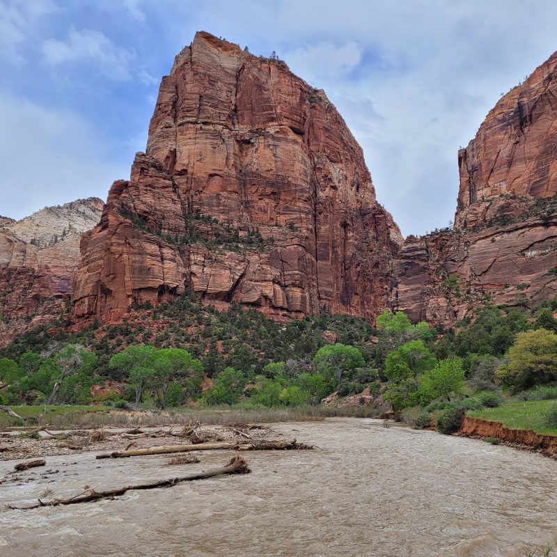
Angel’s Landing
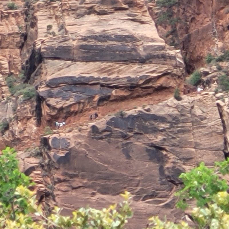
The most determined hikers might take the Angel’s Landing Trail, an extremely challenging route through switchbacks cut into the side of the mountain. It’s not for the faint of heart, however — climbing to the top means navigating almost 1,500 feet of elevation, and the trail itself is quite narrow. It leads to a promontory that overlooks the entire canyon, providing one of the most spectacular views of Zion. For those willing to try it, the reward is well worth the climb. (Note: You do need a permit to hike to Angel’s Landing. If you’re unable to get a permit for your trip, you can hike the West Rim trail to Scout Lookout, but can’t hike any sections that involve chains.)
The Grotto
For a more leisurely hike, visitors to Zion National Park have a variety of shorter, easier trails to explore. The Pa’rus Trail begins near the visitor’s center. The Emerald Pools are a little more challenging, with 400 feet of elevation to a lower and upper lake that is a popular destination. The Grotto Trail is the terminus of the West Rim Trail, and it offers a gorgeous view of Angel’s Landing from the ground.
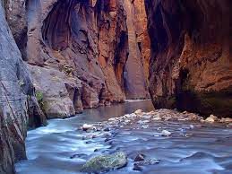
The Narrows
Another very popular trail in Zion National Park is The Narrows, so named because it is the narrowest part of the Virgin River. With walls over 1,000 feet high and places on the river that visitors must wade, this is a very challenging hike that may require specialized gear to navigate.
Be ready to get wet and test your skills on this trail, which is sometimes closed because of flooding.
Plan your visit to Utah today
The Greater Zion area has a lot to offer for outdoorsmen of all levels, as well as for the entire family. There is a lot to do between St. George and Springdale, and Zion National Park is the jewel of the area. You won’t be disappointed with a visit to the southwest of Utah, no matter what of its many charms you decide to explore.