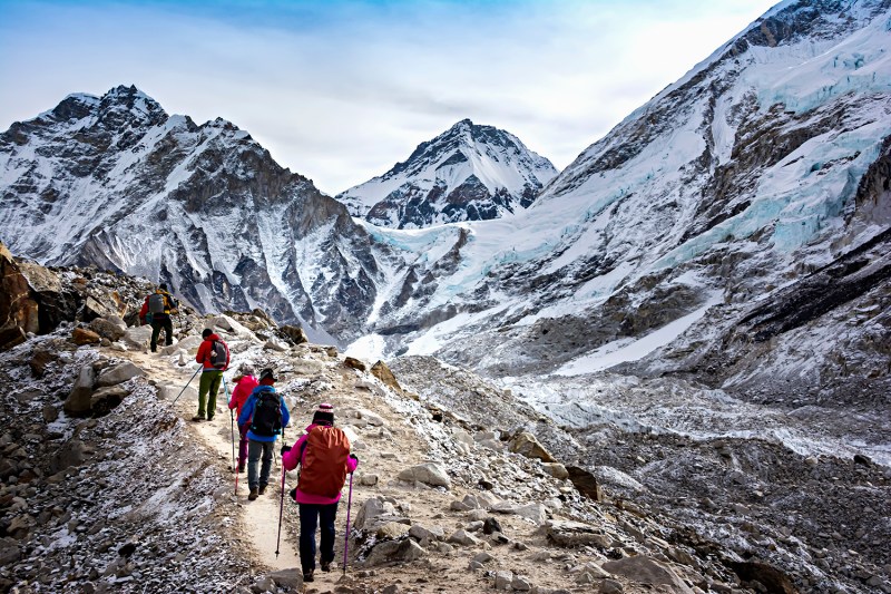
Mount Everest, the tallest mountain in the world, got a little bit taller in 2020. The mountain, called Sagarmatha in Nepal and Chomolungma in Tibet, is now officially 29,031.69 feet (8848.86 meters) tall according to a joint survey done by Nepal and China. The new findings were announced December 8, 2020 in Kathmandu, Nepal’s capital city and the starting point to Everest for many climbers and explorers.
Why Measure a Mountain Again?
You might think that mountains are pretty stable creatures, just standing there all stoic for millennia. They actually move regularly for various reasons.
Everest and the other Himalayan mountains sit on the intersection of the Indian and Eurasian tectonic plates. The plates are crashing into each other (very slowly) and pushing the tallest mountains in the world upwards at about ⅓ of an inch per year.
Related Guides
Also fueling the re-measuring expedition was the lingering question about the 2015 earthquake. The 7.8 monster that killed 9,000 people in Nepal including at least 18 climbers obviously shook the mountain.
The BBC wrote, “Scientists had found that some other Himalayan peaks such as Langtang Himal, mostly to the north of Kathmandu and close to the epicenter, had reduced in height by approximately a meter after the earthquake.”
But how much? Did it grow or sink? Did the snowcap on top change size?
Finally, the long-lasting disagreement between Nepal and China about the official height could be resolved.
Prior to the official change last year, Nepal and many other countries used 29,028 feet (8,848 meters), the height from the Survey of India in 1954. China, on the other hand, preferred to use the height without the ice cap, nearly 12 feet lower, of 29,017 feet (8,844.43 meters). For the last 50 years, neither would agree with the other’s measurement.
The re-measuring expedition could put an end to the disagreement with a joint number everyone could agree on.
How Do You Measure a Mountain?
Measuring a mountain, the tallest one in the world no less, is not an easy task.
Step 1 in measuring a mountain is finding the bottom. The bottom of most mountains is measured from sea level. But sea level isn’t the same in all places.
Nepal had been using the Bay of Bengal, but India surveyed a bay that is closer to the mountain, and provided the data. This gave the surveyors a point closer to Everest where the sea level was known.
Now we have to dig into a little trigonometry. Surveyors measure the distance between different points around the mountain. Then measure the angles between the top of the mountain and each of those points.
After finding two of the angles and the distance of one side, we can use a bit of high school math and find the other angles and sides. The length of one of the triangle sides is the height of the mountain.
Now, not every one of those measurements is going to be perfectly accurate. In their study, Nepal used 12 stations around Everest to measure and compare numbers. The lower measuring stations were all on lower peaks surrounding Everest, some as far as 155 miles away, that could just see Everest.
“Once the surveyor’s beacon had been placed on the summit, surveyors at stations around the summit measured the distance from the six points to the beacon, which meant at least six triangles could be calculated to determine the mountain’s height,” researcher at the Chinese academy of surveying and mapping, Jiang Tao, told state-run China Daily.
After tossing the outliers and averaging the remaining measurements, you’re left with a fairly accurate number.
The main tool at each of these stations was modern laser Theodolite. Sounds like some sort of rock formation but it’s actually a telescope-like tool that measures the exact angle and direction of what you’re looking at through the viewfinder. The surveyors would point the laser at the summit of Everest and when it bounces off the reflector at the summit, they could measure the exact angle to use in their calculations.
There was one problem. A reflector had to be at the summit for the lasers to bounce off of. Someone had to drag some surveying equipment to the top of Mount Everest.
Nepal’s 2019 Expedition to the Summit

Nepal had never measured Everest on their own. The country had always relied on numbers from surveys from India.
“Now that we have a young, technical team, we could do it on our own,” Nepal’s Department of Survey spokesperson Damodar Dhakal, told the BBC.
2017 four Nepalese land surveyors started training to climb Everest. In 2019 they were ready for the expedition. They chose an even harder nighttime ascent as that would be the best time to use the measurement equipment.
“Unlike other surveys of the Everest in the past, we chose 03:00 to minimize errors that could have been caused because of sunlight in the day time,” Nepal’s lead surveyor Khimlal Gautam told the BBC.
The expedition was a success but it was not without its hardships. Gautam came back without one of his toes due to frostbite.
“I could not wear shoes for around six months,” Gautam told a Nepalese news site. “I am not much sad though because my mission was already successful.”
China’s expedition to the Summit
In 2020 China had an expedition planned to summit to complete their measurements. Then COVID hit. Nepal suspended all expeditions. China banned all foreign travelers.
The expedition still went ahead from the Chinese side of Everest and it was the only one to summit in 2020.
Following the same procedure as the Nepalese team did, the survey team measured from 12 lower points around the mountain and used the angles to calculate the height.
Sir Edmund Hillary and Tenzing Norgay first summited Mount Everest in 1953 without modern gear or the known routes we have today.
For the rest of us, the longer we wait, the taller the mountain gets.


