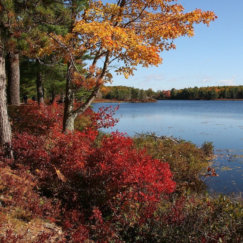
Acadia National Park is one of the most visited parks in the entire U.S., seeing almost 4 million visitors this past year. It’s easy to see why. Instituted as a national park in 1919, this piece of Maine is home to gorgeous forests, boulder-strewn clifftops, and a stunning coastline all in one place. One of the main draws is that it’s one of the best places to see fall colors, but it’s also stunning to visit during any time of year. If you want to experience some of the best scenery New England has to offer, here’s everything you need to know to make your trip a huge success.
The lay of the land
Acadia National Park spreads across two-thirds of Mount Desert Island, a 108-square-mile island off the northern half of Maine’s coast (called “Down East” in these parts). Mount Desert Island also contains the town of Bar Harbor, which has hotels, restaurants, cafes, outdoor suppliers, and several worthwhile museums. Smaller towns like Northeast Harbor and Southwest Harbor provide a more low-key stay with fewer crowds.
Apart from Mount Desert Island, the national park also includes a section of the Schoodic Peninsula, about an hour’s drive east of Bar Harbor (or a 45-minute ferry ride operated by Downeast Windjammer). The Cranberry Isles are also part of the national park (accessible by ferry only from Southwest Harbor), as is the stunning Isle Au Haut, a remote island with limited ferry access from the town of Stonington, a 90-minute drive southwest of Bar Harbor.
How to plan your trip to Acadia National Park
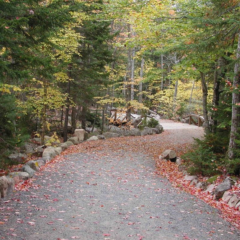
Book lodging, campsites, or a rental car well in advance, especially if you’re hoping to arrive at peak season. Bring appropriate gear — expect rain and cool temperatures even in the heat of the summer. Apart from this, Acadia is a pretty easy place to explore without much preparation. All of the trails are for day use only, and most are well-marked (though it’s wise to pick up a good map before heading into the forest).
Entrance passes, valid for one week, are required no matter what time of year you go. The National Park Service asks that you purchase online before you arrive and keep it displayed on your windshield at all times. Please also be aware that several activities around the park, such as Cadillac Summit Road ,will require reservations from May to October.
This national park is open year-round, though many park roads close from December to mid-April. The majority of visitors come during the busy summer season, which runs from June through August. September and early October are excellent months to visit. By this time, the heavy summer crowds have gone home, the cooler early autumn weather is ideal for outdoor activities, and you can catch some fiery fall colors along the trails. Things start to wind down by mid-October, with campgrounds and visitor centers closing for the season, and many (but not all) services in Bar Harbor closing until spring.
Camping options at Acadia National Park
Acadia National Park offers a variety of camping options at four different campgrounds: Blackwoods, Seawall, Schoodic Woods, and Duck Harbor. All campgrounds require reservations, so it’s important to book these spots in advance before you arrive.
Blackwoods Campground
The Blackwoods Campground is excellent due to its proximity to the main attractions. Since it’s just 5 miles south of Bar Harbor, you’ll easily be able to see the park’s most popular sites, such as Cadillac Mountain and Sand Beach. Blackwoods is perfect for visitors who want easy access to hiking trails, park amenities, and local restaurants, and it’s the most ideal campground for first-time visitors or families.
Seawall Campground
If scenic camping is your thing, try the Seawall Campground, where you’ll be right at the cusp of the action. This campground is known for being a tranquil getaway, and it’s just walking distance away from the rocky shoreline. Southwest Harbor is also nearby, which is a quieter alternative to Bar Harbor if you’re looking for that peaceful measure of solitude. Those who hope for a more nature-focused experience should choose this campground.
Schoodic Woods Campground
Located in the Schoodic Peninsula, this campground is often quieter. It has access to several hiking and biking trails and offers some stunning coastal views to boot. If you’re traveling in an RV, this is the park for you. Water and electric hookups are available, and the park is equipped with modern facilities. Due to demand, reservations are required up to two months in advance.
Duck Harbor Campground
Duck Harbor Campground is the most unique of the four campgrounds, so if you’re looking for the most adventure, this is the one for you. Located on Isle au Haut, this campground is only accessible by mailboat from Stonington, Maine. You must have a reservation before you arrive, and your camping party can’t exceed six people. The campground has five lean-to shelters with three-sided walls, a roof, and a floor. With just a composting toilet and a hand pump for water, you’ll be about as removed from civilization as you can get.
Fun things to do at Acadia National Park
Hiking
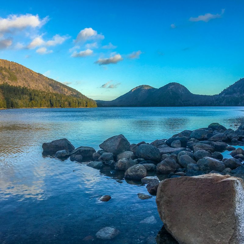
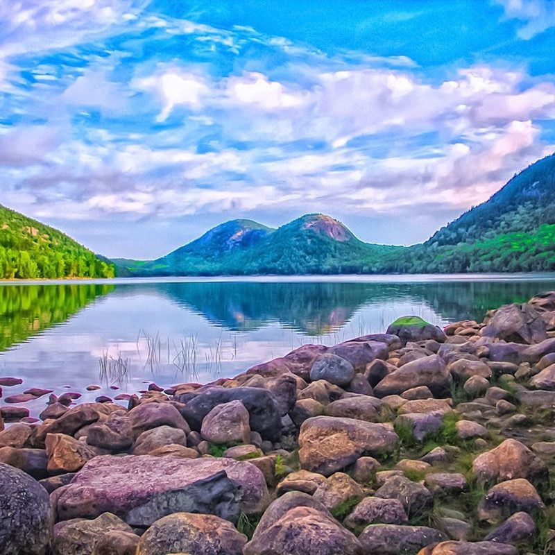
Acadia’s diverse hiking trails take in clifftops, craggy coastlines, and lush valleys. You’ll find plenty of variety in difficulty, from flat, easy-going walks like the loop around Jordan Pond (best followed with tea and popovers on the lawn of the Jordan Pond House) to the thrilling vertical ascent via iron rungs and narrow cliffs of the aptly named Precipice Trail. The highest point in the park is 1,530-foot-high Cadillac Mountain, which some claim is the best place to be at sunrise. Various trails lead up to the top; our favorite is the 7-mile roundtrip ascent on the South Ridge Trail. Along the way, you’ll enjoy spectacular views over island-dotted Frenchman Bay. There’s also a road to the top.
Biking
In the first half of the 20th century, philanthropist and noted equestrian John D Rockefeller donated funds for the creation of 45 miles of carriage roads. Made of crushed stone and crisscrossing the island’s forests, these idyllic car-free lanes make the perfect setting for a bike ride. Pick up a map of the Carriage Roads from a visitor center (Hulls Cove, which has carriage lanes right outside, is a good bet). Various outfitters in Bar Harbor hire bikes for the day, including Bar Harbor Bicycle Shop.
Island attractions
Even if you have little interest in Acadia’s trails, there are plenty of other ways to spend a few days on Mt Desert Island. Various gardens dot the park, including the stunning Thuya Garden with its massive dahlias. If the weather turns sour, you can retreat to the Abbe Museum, a Smithsonian affiliate that delves into the history, traditions, and beliefs of the Wabanaki. Known as “the people of the dawn,” they have inhabited this region for thousands of years.
While the Cranberry Isles aren’t technically part of Acadia National Park, they make a pleasant day trip, especially when timing your visit with a meal at the Islesford Dock Restaurant, which serves outstanding seafood right over the water (reservations required). Speaking of dining, you can’t leave Mount Desert Island without partaking in at least one lobster feast. Thurston’s Lobster Pound, on the quieter side of the island near Tremont, is a perennial favorite for its delectable crustaceans. On the way there, you can stop for a look at the 1858 Bass Harbor Head Lighthouse, overlooking one of Maine’s most photogenic seascapes.