San Francisco: It’s the city that never seems to slow down. There’s so much to see and do throughout the San Francisco (SF) Bay Area, including things to do in the great outdoors. The Bay Area may be best known for great wines, fantastic gastronomy, groovy counterculture, and multinational tech companies, but there’s plenty more to see and do outside.
Where should we go, and what should we do? Fortunately, we have some ideas. Here are some of the region’s best places to hike, bike, surf, swim, and simply enjoy.
SF may feel “very online”, but it’s perfectly fine to opt outside.
As the home of Apple, Google, Facebook, Twitter, and many more tech companies, it’s hard not to think of the internet when thinking about the San Francisco Bay Area. With that said, all that viral content that you love to check on Instagram and TikTok doesn’t create itself. If you really want to wow your friends and followers, why not show them one of Northern California’s gnarliest surfing beaches, or perhaps a redwood forest that’s up the road from some of the region’s best wineries?
While SF proper has plenty of urban amenities that might make it feel hard to leave, you’ll be even more amazed when you step outside and experience the land and the waters that make this region great. Even better, you don’t even have to leave the city to head outdoors! From the national park that stretches into city limits to the mountain that soars above the wineries, here are some of the Bay Area’s finest spots to explore the great outdoors.
Here’s where to head out in SF
Baker Beach and Golden Gate Overlook
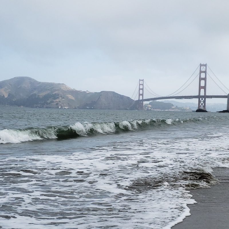
Did you know that San Francisco has a national park within its city limits? Indeed, the Golden Gate National Recreation Area spans across both sides of the Golden Gate Bridge. If you’re looking for an easy starting point for a nice hike, or if you’re looking for a nice beach with amazing views, Baker Beach is an ideal spot to start exploring. Though the rip current-prone cold ocean water doesn’t make this beach an ideal swimming hole, it is a wonderful spot for surf fishing and beachcombing. If you prefer hiking, you can also catch the coastal trail that connects to other areas of the park.
Though there’s really no wrong move to make from here, we highly recommend taking the trail north to Golden Gate Overlook. Developed in 2012 to mark the 75th anniversary of the Golden Gate Bridge, this overlook is where three regional trails converge, and it’s an amazing spot to see the native flora alongside the world-famous bridge.
Golden Gate Park
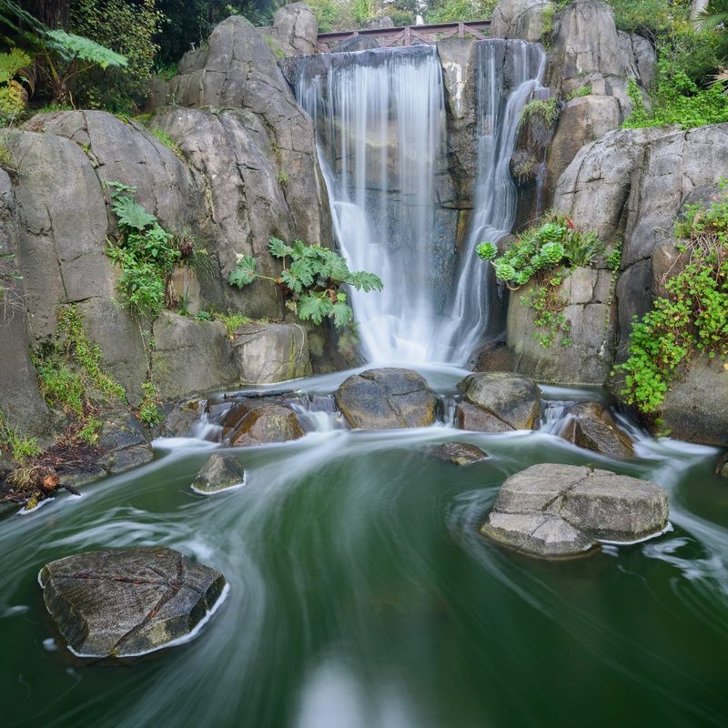
When you arrive here, you’ll understand why Golden Gate Park is America’s third most visited park. It’s a unique getaway where you can stretch out amidst San Francisco’s busy urban landscape. Try starting at the Japanese Tea Garden: It’s America’s oldest Japanese-style garden, and the calming vibes of the five-story pagoda, the waterfalls, and the azaleas and bonsai trees will help in soothing away any stress you got from getting here. Landscape designer Makoto Hagiwara began work on the Tea Garden in 1894, but city authorities nearly did away with it entirely after Hagiwara and his family were forcibly removed and incarcerated in an internment camp during World War II. The city turned around and began to restore the garden in 1952, and the Lantern of Peace was installed the following year to turn the page and embark on a new chapter of history.
If you want some arts and culture alongside your open nature, head to the de Young Museum to discover art from around the world. For rare wildlife, check out the California Academy of Sciences. You can discover an island, a waterfall, a row-boating lake, and great bird watching opportunities at Strawberry Hill. You’ll even find bison and a Dutch-style windmill on the west side of the park, where you can continue exploring all the way to SF’s Ocean Beach.
Twin Peaks and Sutro Tower
Rising up to 922 feet in elevation, Twin Peaks offers 64 acres of San Francisco in its natural state. You may very well encounter wildlife like brush rabbits, coyotes, white-crowned sparrows, and even the endangered Mission Blue butterflies here, as this expanse of native grassland and coastal scrub is among the last of its kind in the Bay Area. You’ll then find 360-degree views of the city and the Marin Headlands at the north peak overlook, and you can extend your hike by taking the Creeks to Peaks Trail that connects to Islais Creek in Glen Canyon.
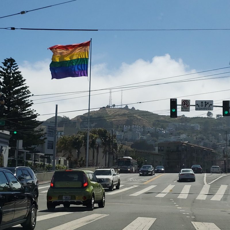
While in the area, you might notice a very telling set of antennae. That’s Sutro Tower, which reaches up to 1,811 feet above sea level and plays a critical role in the region’s communications infrastructure by transmitting TV, radio, and wireless internet signals to the entire region. If you eventually need some urban amenities after your hike here, it’s a fairly short stroll down to the Castro — one of America’s most famous hubs of LGBTQ+ culture — and discover a wide array of restaurants, shops, and bars to delight your senses regardless of your sexual orientation and gender identity.
For more adventures, venture out to these great outdoor destinations outside city limits
Stinson Beach and Mount Tamalpais
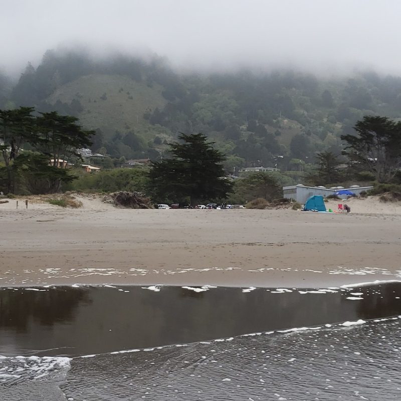
Stinson Beach may only be about 24 miles north of downtown San Francisco, but the 45 to 60-minute drive feels like the ultimate transition into another world, especially once you get off the 101 Freeway, and you begin to experience the lushly landscaped twists and turns of Highway 1 – Shoreline Highway in Marin County. Since Stinson Beach is also part of the Golden Gate National Recreation Area, you’ll discover plenty of wide-open spaces to explore. If you prefer a chill day at the beach, take the short trail down from the parking lot, then enjoy the wide stretch of sand. If you want to explore the water, Stinson Beach offers some of Marin’s best surfing and swimming waves.
If hiking is more your jam, you can catch a trailhead that connects to the Dipsea Trail on the inland side of Shoreline Highway: It features a pretty steep change in elevation, yet it also features a nearby stream and an old-growth redwood forest. Another stellar hiking option is the Matt Davis Trail: This trail starts at a residential street off Shoreline Highway, and it features amazing forest and coastal views as you gain elevation. Both trails connect the Golden Gate National Recreation Area to Mount Tamalpais State Park, and the Matt Davis Trail is especially worthwhile if you want to connect to trails that lead to the higher elevations of Mount Tam.
Guerneville and the Russian River Valley
Situated about 75 miles northwest of Downtown SF and 20 miles northwest of Santa Rosa, Guerneville is a great launchpad to explore and enjoy the best of what Sonoma County has to offer outdoors. If you take Armstrong Woods Road north from Highway 116 – River Road (the town’s main street), you’ll eventually reach Armstrong Woods State Natural Reserve, where you’ll find coast redwoods that date back as much as 1,400 years and reach as high as 310 feet above ground level. If you prefer exploring the open waters, stay in town and head to Johnson’s Beach to partake in the local tradition of swimming, rowing, floating, floating, and sunbathing at the mighty Russian River.
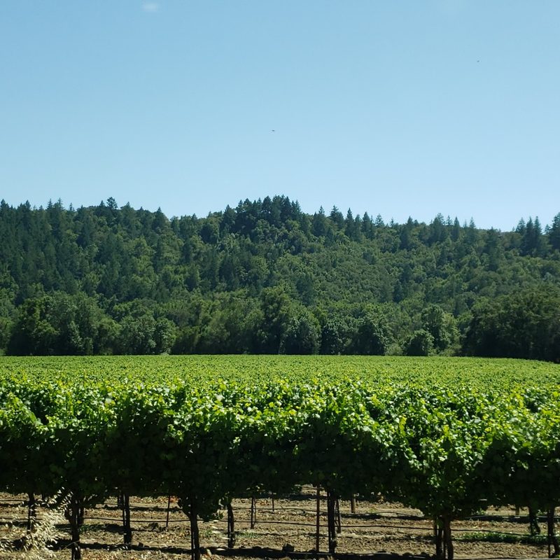
For even more adventures, you can take Highway 116 all the way west to Highway 1 – Coast Highway, where you can find harbor seals, migrating gray whales, and other local wildlife enjoying the fantastic scenery at Goat Rock Beach. If you take River Road east, it’s a great way to check out some of Sonoma County’s best wineries and vineyards, and if you catch the slight turn onto Westside Road, you can catch even more wineries en route to Healdsburg, where you can find a plethora of wineries and restaurants in the town’s incredibly charming downtown. Even if you opt to stay in the Guerneville area a little longer, you’ll find plenty to see and do along the Russian River.
Robert Louis Stevenson State Park and St. Helena
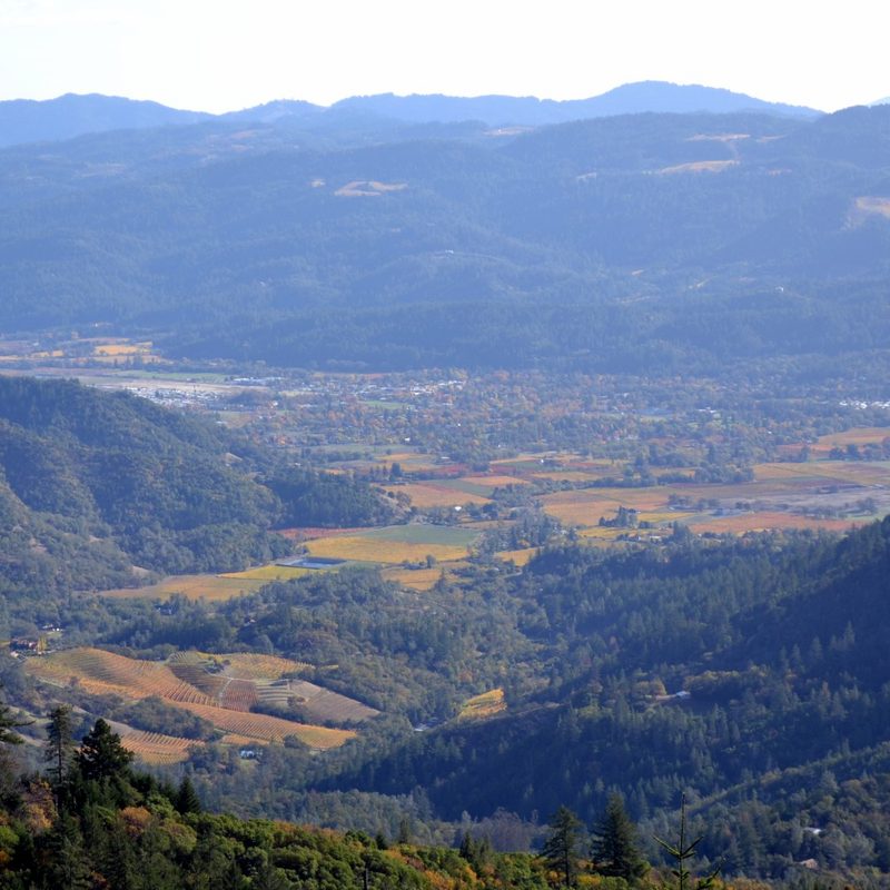
Located in the Napa Valley and about 80 miles north of Downtown SF, Robert Louis Stevenson State Park has provided ample inspiration for writers like Robert Louis Stevenson, Ambrose Bierce, and Ursula Le Guin, with its alluring and sometimes mysterious natural beauty. The park features chaparral on the south side, and evergreen forests in the canyons and on the north-facing slope of the mountain. The crown jewel of this park is Mount Saint Helena, which rises up to 4,342 feet above sea level, features five peaks that span across three counties (Lake, Napa, and Sonoma), and is one of the few areas west of Sacramento that regularly experiences snowfall every winter.
If you opt to take the five-mile trail to the summit, you may be able to see most of the Bay Area to the south and Mount Shasta to the east. Down below, it’s about a nine-mile ride or drive to Calistoga, then another eight miles to St. Helena. Dubbed “Napa Valley’s Main Street,” St. Helena offers plenty of respite after a grueling hike and/or bike ride with a compact central village that’s jam-packed with wineries, restaurants, and boutiques.
Mount Diablo
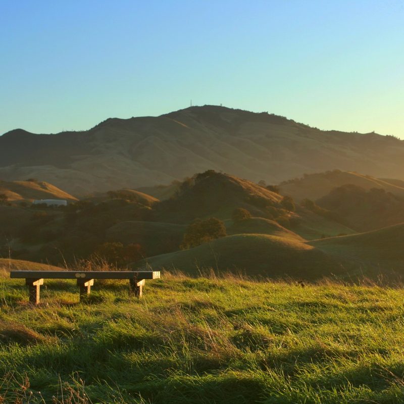
For a different kind of Northern California experience, head to Mount Diablo in the East Bay. Located about 40 miles east of Downtown San Francisco, and near the towns of Danville and Walnut Creek, Mount Diablo soars up to 3,849 feet above sea level, making it the highest peak in the Bay Area. On a clear day, the Sierra Nevada mountain range to the east is very visible, and parts of Yosemite National Park may even be visible.
Beyond the peak, you’ll discover over 400 plant and animal species in this roughly 20,000-acre state park, as well as oak forests, waterfalls, grasslands, and even sandstone formations and caves at Rock City. If this still isn’t enough adventure to pack into your day trip here, it’s a fairly easy drive to Concord or Walnut Creek to explore the local dining scene.
Castle Rock State Park
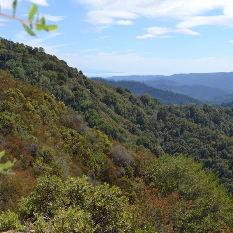
Situated about 54 miles south of Downtown San Francisco, 25 miles south of Palo Alto, and 23 miles west of Downtown San Jose, Castle Rock State Park offers some charming and scenic peace and quiet that’s surprisingly close to the hustle and bustle of Silicon Valley. This park offers 34 miles of rugged trails that connect to even more trails that allow you to explore a very special wild side of this stretch of the Bay Area. Here, you can take your time exploring lush coast redwood forests, stunning sandstone rock formations, and groves of California black oaks. This is a prime location for rock climbers, and some areas are even open for horseback riding.
If you seek the ultimate rugged outdoor experience, designated Castle Rock campsites are available for reservation. If you prefer more of a day trip followed by a return to civilization, it’s a fairly easy drive or ride down to Saratoga to unwind after a long day in the wilderness, and it’s too much farther to reach the always humming Silicon Valley hubs of Palo Alto and San Jose.
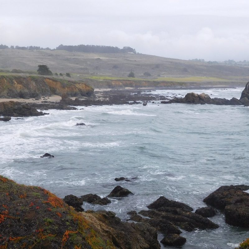
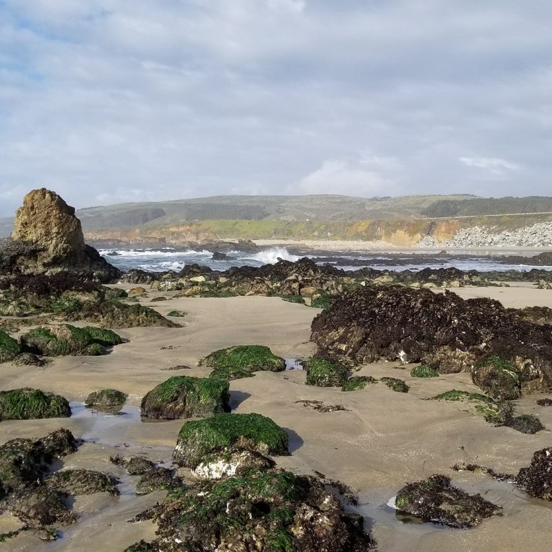
Pescadero State Beach
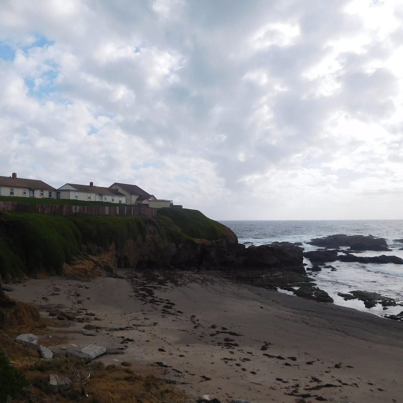
While Half Moon Bay tends to attract more visitors along the coast south of San Francisco, Pescadero offers a ruggedly beautiful stretch of California coastline that might make you forget how close you are to Silicon Valley. Located about 45 miles south of Downtown SF and 30 miles west of Palo Alto, Pescadero State Beach has plenty to offer: A wide and sandy beach between the north and south parking lots, hiking and birdwatching at the north end of the beach, nearby wetlands to hike alongside, and a series of rocky coves and tidepools at the south end of the beach.
Perhaps the crown jewel of this area can be found near the Pigeon Point Lighthouse. Closest to the lighthouse, you’ll find a boardwalk that leads to an overlook with gorgeous views of the coastline, the local elephant seal population, and gray whales when they’re migrating through the region from January to April. South of the lighthouse, you can connect to Whaler’s Cove, which offers fantastic tidepooling when the seals aren’t using the beach. Though you won’t find much of any urban amenities in Pescadero, you can take Highway 1 another 23 miles north to Half Moon Bay for an available campground, as well as for shops, restaurants, and additional lodging options.
We hope this gives you a better idea to what to see and do outside when you’re in the SF Bay Area. For more great ideas for new adventures, check out the 20 best national parks to explore, Lake Tahoe’s best outdoor adventure spots, our guide to the world’s loneliest highways, and our tips for surviving these turbulent times for air travel. Wherever you go next, we hope you enjoy the journey and all the amazing sights along the way.


