Are you looking at maps more often these days, scratching an itch to resume traveling? You’re not alone, as Google Earth has practically become the default quarantine homepage for any soul in custody of a computer.
While it’s an itch we can mostly only scratch digitally right now — on top of exploring our own immediate environments — there are many avenues one can take. There are livestreams, wildlife cams, and real-time shots of lovely beaches, all there to take a bit of the stagnant sting out of the pandemic. There’s also an entire world of old maps curated by the University of Texas that’s both educational and entertaining. The Perry-Castañeda Library Map Collection (PCLMC) is an incredibly artistic dive into the history of cartography and global geography in general.
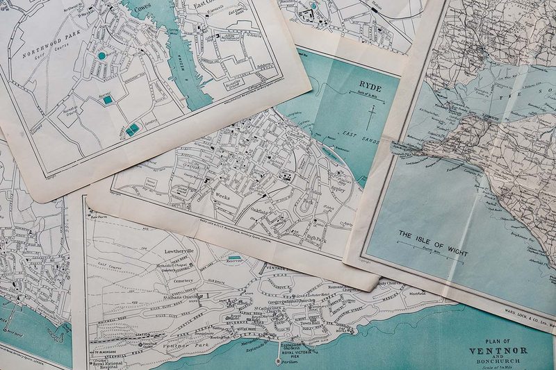
These are the awe-inspiring, hand-drawn maps of old that you tend to associate with pre-industrial times. Sure, Google Earth’s got satellite imagery, 360-degree views, nighttime perspectives, and more, but that stuff is worthy of a screen, not an art gallery. The university’s deep well of maps from yesteryear reminds us that before technology, a deft hand was necessary to portray a city or nation in a way that would be useful to the masses.
All told, the library includes more than 250,000 maps. The older items are fun to gawk at but there’s also an abundance of useful current maps. There are maps dealing in current events, detailing the spread of coronavirus across the globe or the recent locust swarms in East Africa. And the collection is celebrating its 25th anniversary this year, with a new and improved website in the works.
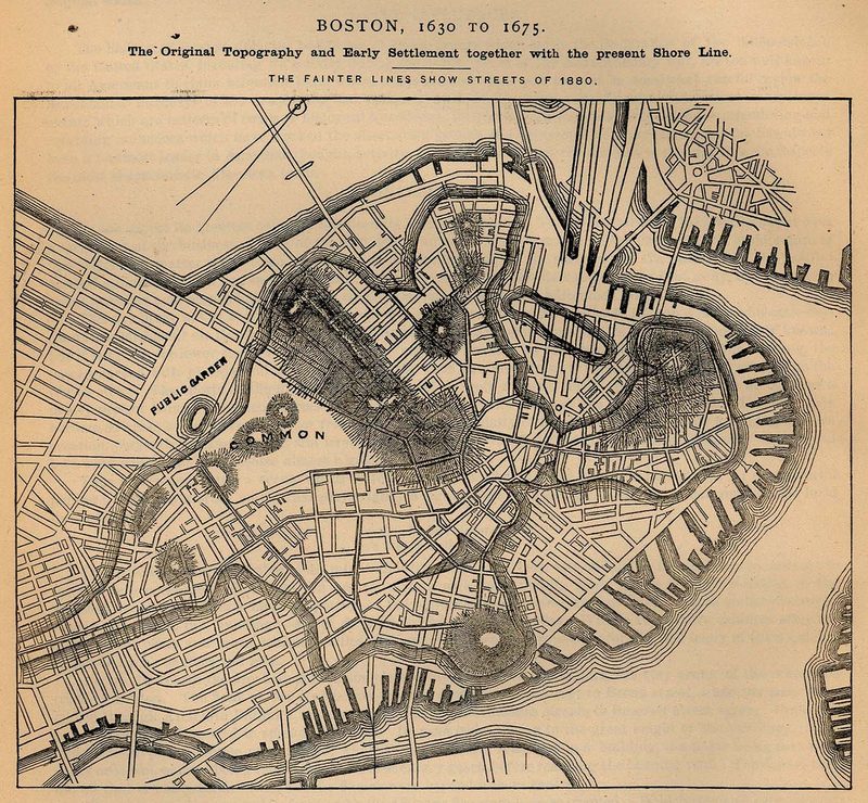
The historical maps section, though, is the undisputed king. You can get lost in old topographic maps, 17th-century renderings of iconic east coast American cities, famous New York boroughs, and so much more. Most are of a high enough quality that you can really dig in, zooming in and hovering over areas from long ago. The detail is impressive and it’s fun to see various cities and countries evolve by looking at certain maps in chronological order.
Katherine Strickland is the collection’s Maps Coordinator and we couldn’t resist asking her if there was a map she prized most. “It’s hard to pick a favorite, let’s face it, I have a pretty fantastic job!” she says. “But there are aspects of the collection that I gravitate towards for different reasons.”
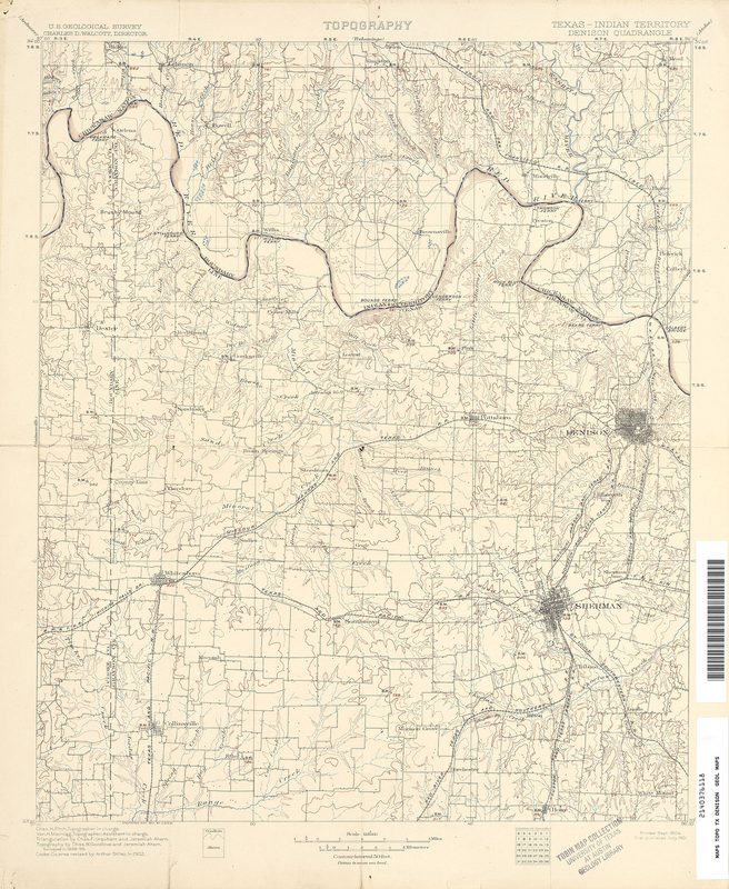
Strickland is especially fond of the U.S. Topographical Maps (1881-1945), as they’re both cool looking and a great resource for researchers. One of her favorites is an old map of Denison, Texas. “There’s so much going on in it! Oklahoma is still called the Indian Territory. It shows the intersection of major north-south and east-west railroad lines,” she says. “And you can see the communities that were swallowed up by Lake Texoma when they dammed the Red River in the ’40s. The historical topographic maps have information that would otherwise be lost or hard to find.”
She also cites the Sanborn Fire Insurance maps, for their beauty and usefulness. “I also live old train schedule maps,” Strickland says. “And a gift of North American city maps spanning 1940 to 2010. They are a great snapshot of cities and towns, map design, and different approaches to mapping.”
The collection is always acquiring new pieces, even if they’re old in nature. A big influx came by way of the United States Geological Survey years ago. By way of the Federal Depository Library Program, the collection took on many nautical and aeronautical charts from all over the globe. Many came in through government agencies like the CIA. Strickland says they recently took on some fascinating World War maps via private collections. In fact, she and her team are presently working on scanning in maps from a machine gun battalion officer named Roland T. Benton, who served in both World Wars.
Obviously, the university collection is a great resource for academics and the curious. It’s also utilized by folks in the design, landscape architecture, and linguistic fields. Strickland says one researcher was using the maps for sociological studies, looking to illustrate gentrification. “Many veterans use the collection to research where they served,” she adds. “Genealogical researchers and journalists have always been faithful users of the PCLMC. Both the Washington Post and Associated Press have gifted us with their map collections because the website was invaluable to newspaper cartographers before the prevalence of online mapping.”
From 1995 to now, the PCLMC has digitized some 55,000 maps from the print collection. The website continues to be one of the most-used in the UT system, drawing 70,000 hits on average per day. Strickland and her colleagues continue to entertain and forge valuable relationships with organizations all over the globe. And, later this year, her team will look to launch a crowdfunding campaign to set up a crowdsourced project to geo-reference the online maps.
Go on, get lost in map land. It’s a great way to spend a few hours or an entire week, losing yourself in a time capsule or some old stomping grounds.