

Here’s a new way to get out and explore the world—it’s called GeoTouring and all you need is your iPhone or a GPS enabled device to do it. We recently tested it out on a tour of the beautiful areas around Eugene, Oregon and haven’t looked at any journey quite the same again. Check it out…
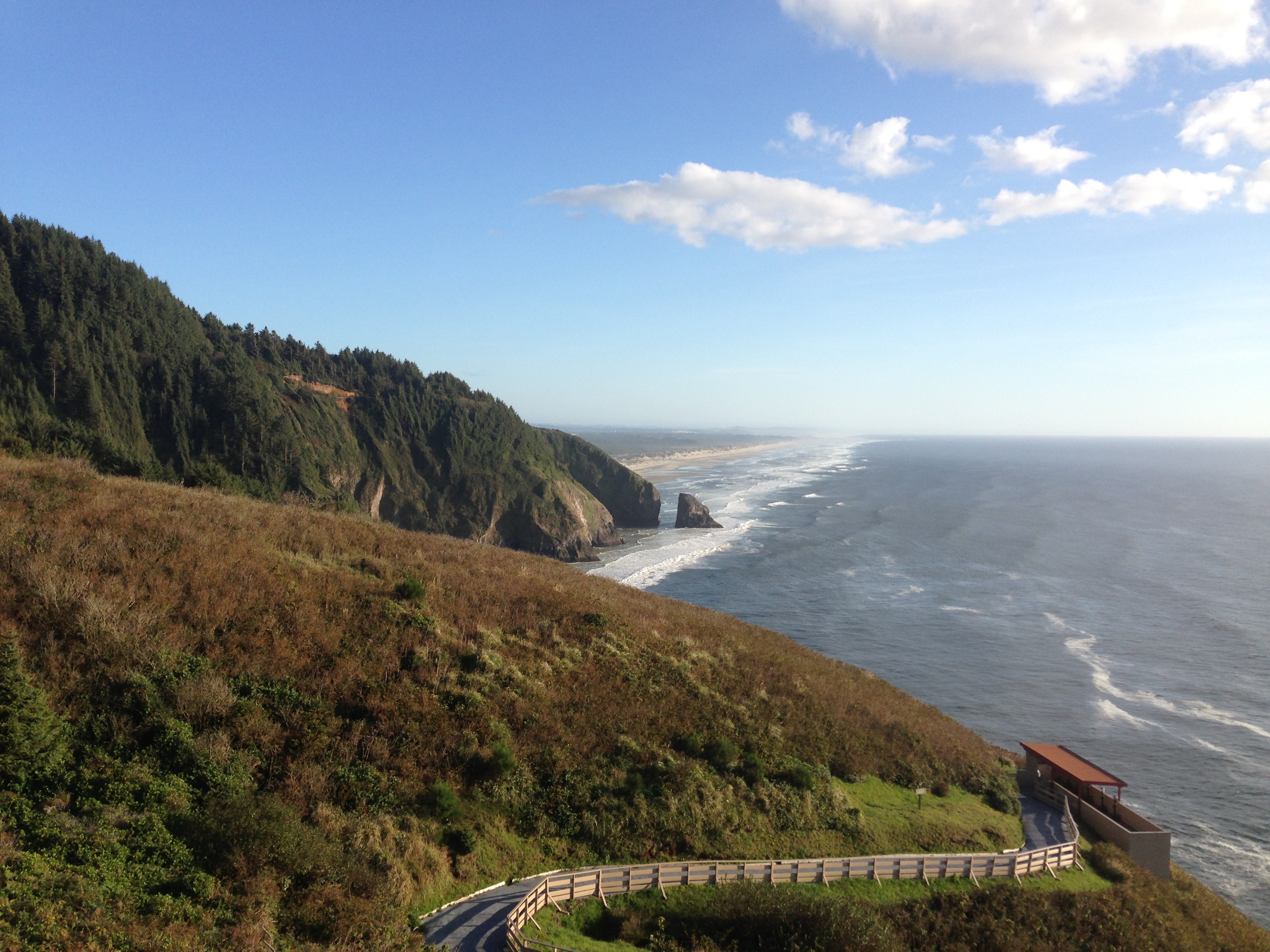
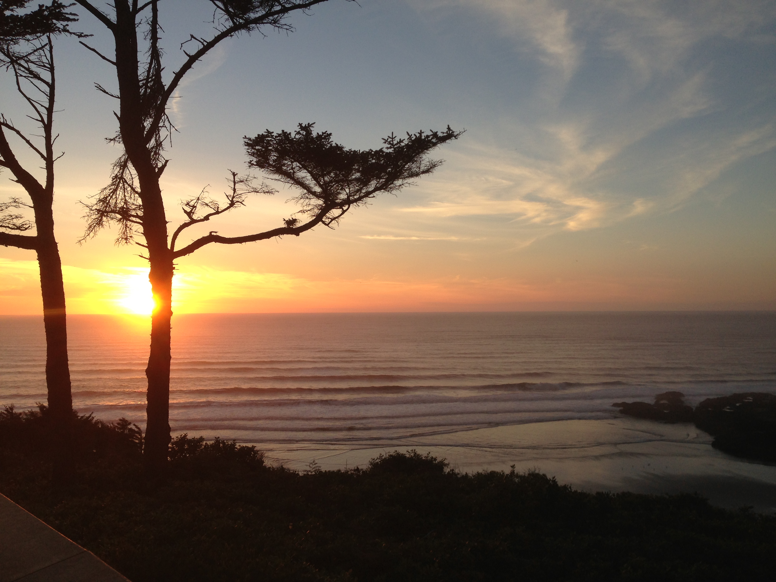
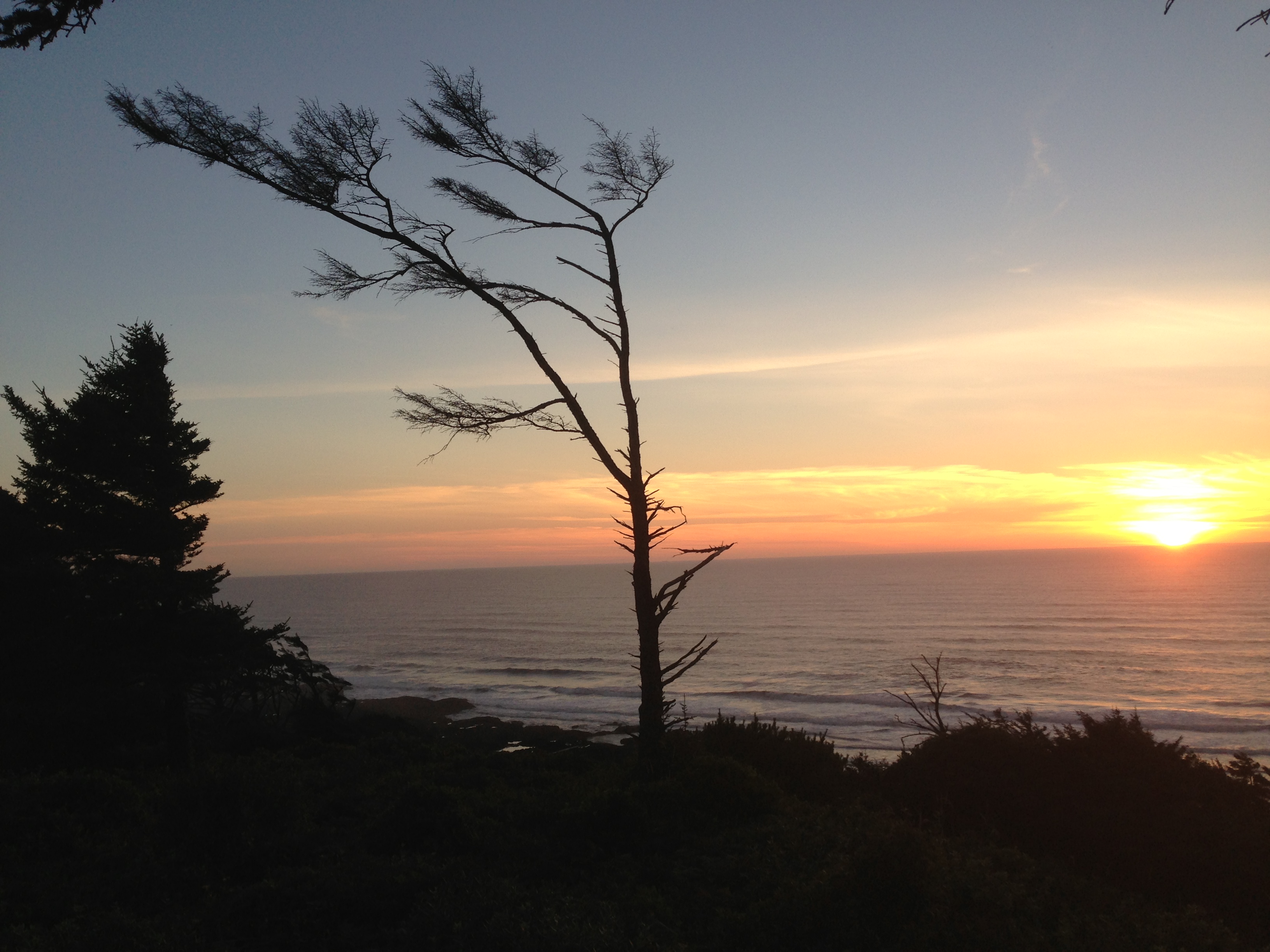
The parking lot at Cape Perpetua isn’t anything spectacular. It’s hidden in a mass of trees and up a hill; tucked just far enough away from the intoxicating beauty of the actual Cape, which can be found on the cliff filled coast line of central Oregon. It is hands down, one of the most beautiful places in North America to watch a sun set.
But we were focused squarely on the parking lot. It was about 30 minutes till sundown and the GPS-based geocaching App on our iPhone was telling us to jump the knee-high metal barrier between the parking and the woods. Strange. Following the straight red line on the screen towards the blue dot demarcating this particular geocaching goal—our last on this three day trip, we found a small, dirt path that led down a hill. It looked like no one had been here for a long time. The App was telling us we were getting closer. 500 feet, then 200 feet, then 78 feet….a few minutes later, we were in a gorgeous clearing between a slew of towering spruce trees covered in a gauzy layer of moss, quiet except for the chatter of some birds. It looked like the land time had forgotten or that forest with talking trees from Lord of the Rings. We had found the blue dot on the screen, and once we were done admiring the secret beauty of this place, it was time to look for the hidden box and sign the log book inside.
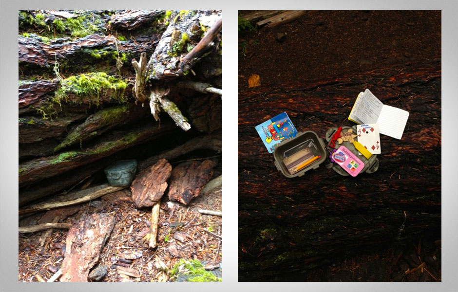
We are officially geocaching, a GPS based scavenger hunt that since May of 2000 has garnered over five million fans worldwide, though admittedly, before this trip it was something we’d never heard of. The goal of each geocache (the word used for the hidden box) is two headed—first, you are supposed to find the hidden box that is filled with trinkets left by previous geocachers (you can take one but if you do, leave a new one) and a log book to sign…and second, to experience the location where it has been placed, which aren’t always the most obvious places, like the random off road parking lot terrain mentioned earlier.
There are varying levels of involvement (which you can read on their website) and GeoTouring, which is what we’re up to, is the most accessible and rewarding for travelers. A GeoTour is set up with local knowledge to show you worthwhile points of interest along a single route. In a nutshell, it’s an engaging way to find both off the beaten path treasures and famous tourist icons, without the fuss of a guide or the clutter of a tour book.
Here’s how it works:
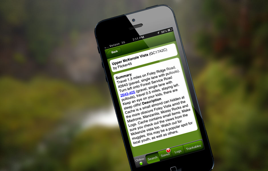
Download the Geocaching App on your smart phone or GPS enabled device. It costs $9.99. Create a user profile, which gets you into the App and onto the website. Online, there’s a list of GeoTours—a string of geocaches set up along a “spoke,” or a simple line of travel dotted with points of interest—between point A, which in our case was the city of Eugene, and point B, which on the first leg of our trip was McKenzie and on the second segment of the trip, Florence (so, two spokes—Eugene to McKenzie and Eugene to Florence). Each spoke and geocache has been crafted by local experts and are vetted and approved by the Geocaching company, but it’s not a guided tour. It’s just you, your crew and whatever mode of transport you desire.
Once you find the routes you’d like to explore, all you have to do is start out on the road and open your Geocaching App, which will automatically find the closest geocaches. Those on the GeoTour are indicated in the headline. Click on the geocache and you’ll find some information about the location, a GPS enabled map of how to get there, and a few clues about where to specifically find the cache. Some people try to find all the geocaches and others are content with finding those that sound the most interesting. The only winning in the game of geocaching is measured in the richness of each find, not in the quantity. So, no matter, it’s up to you which to hunt.
It’s ok if it sounds a little confusing. It did to us at first, when we were heading out of Eugene on the McKenzie route that takes you through the Cascade Mountains, but after the first try, it became resoundingly clear.
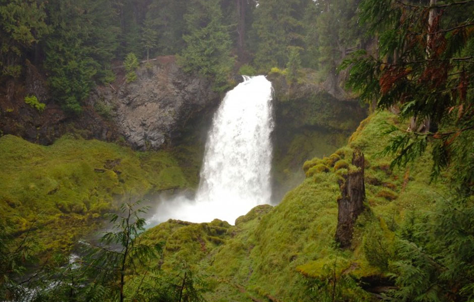
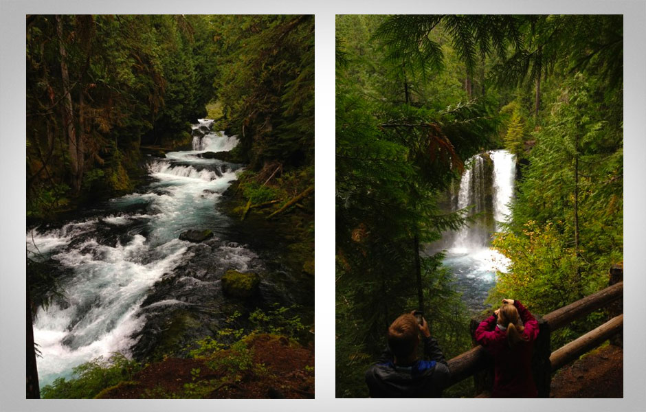
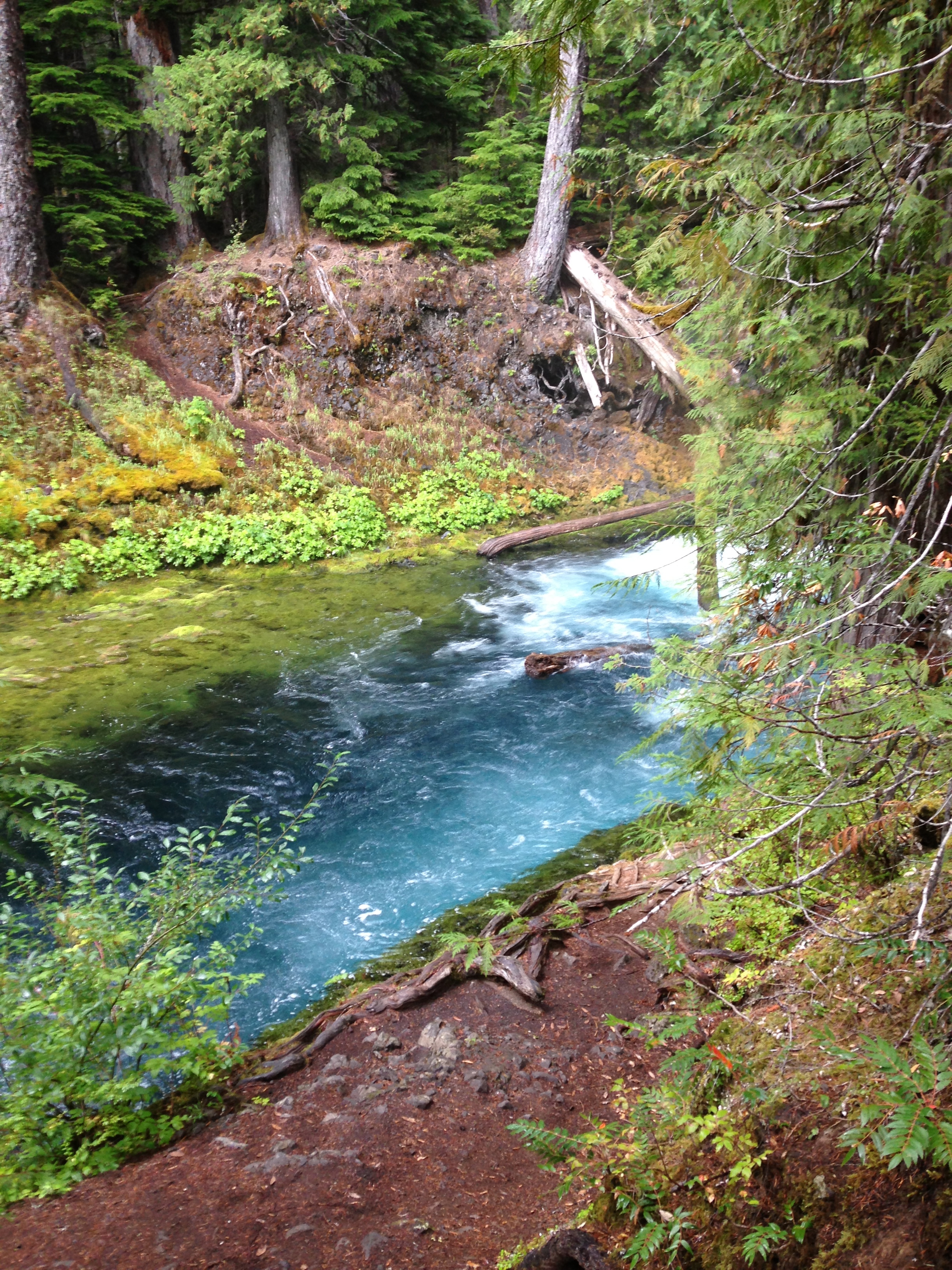
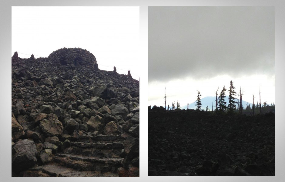
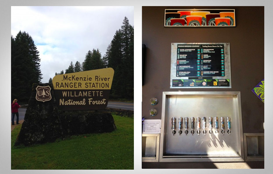
Driving along route 126 that follows the McKenzie River, we turned on the App and found a geocache listed as Sahalie Falls and Koosah Falls in Willamette National Forest. We learned we were but a few miles away from some gorgeous waterfalls and decided to follow the GPS map to the geocaches that were hidden around them. Once we found a camouflaged box hidden in a fallen log with some trinkets inside, plus the spectacular views of these hidden falls, we were hooked.
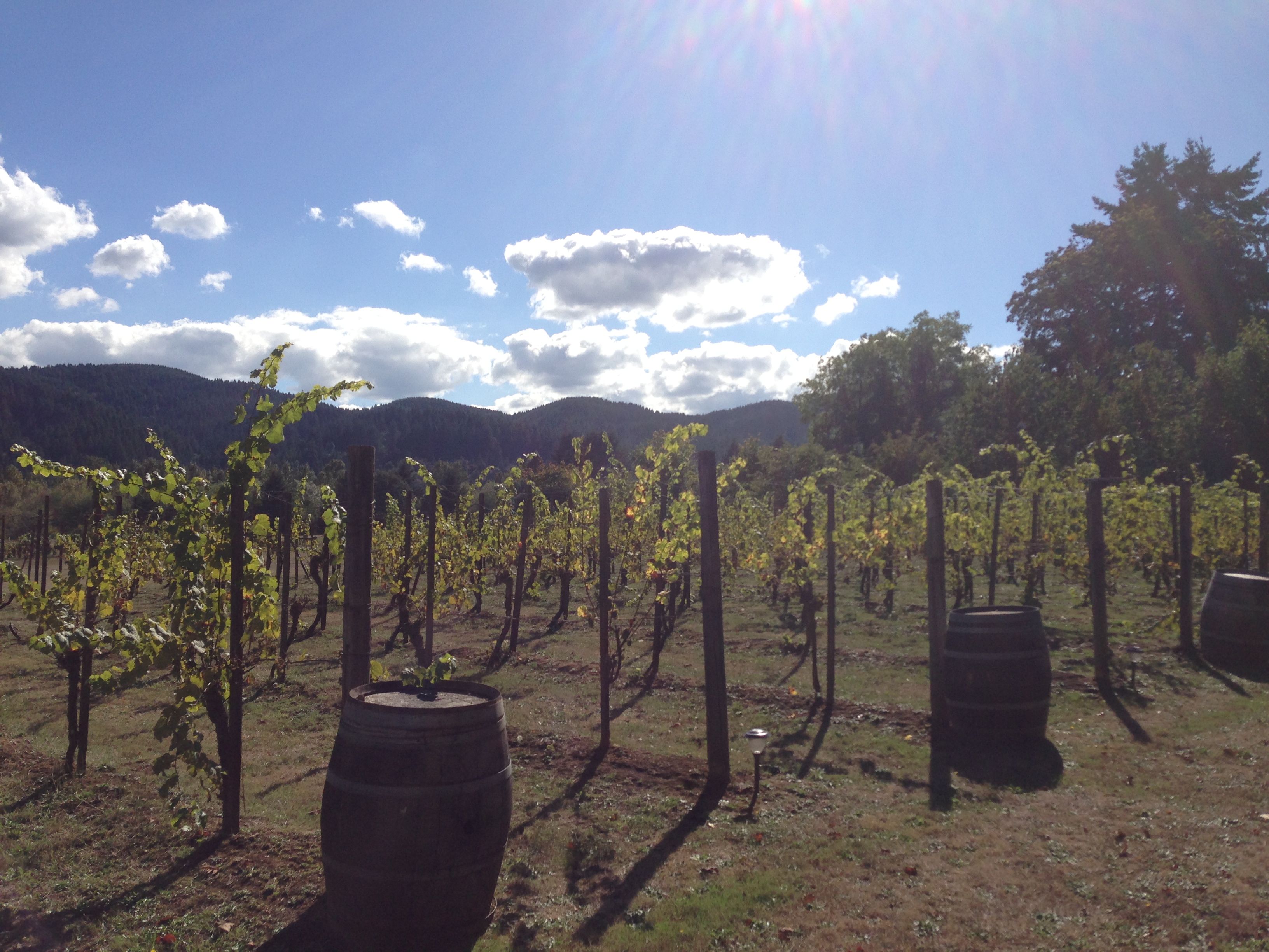
After that, we used the App to find our meals, like dinner at Takoda’s Restaurant on the McKenzie route—an awesome country crocking’ local diner with a locally sourced pulled pork sammy or Our Daily Bread, a restaurant that’s in an old church and serves regional food, local wines and microbrews on the way to the Oregon coast. While passing through Eugene, we discovered the local’s most beloved brewing company—Ninkasi, just by using the app. On the way out towards the coastal town of Florence, we found the Domaine Meriwether winery and tasted some Oregon Wine. Once we were in Florence, we found one of the largest sea caves on planet earth.
At the end of three days of constant discovery, we ended up in the parking lot at Cape Perpetua. After finally locating the hidden cache behind the parking lot at Cape Perpetua, we ambled down towards the scenic viewing area, a wooden deck perched over the exotic spruce and cypress tree lined shoreline, and watched the sun dip into the cool Northwest Pacific.
We might’ve found this spot—or any of the places we hit up—in a tour book, but destinations aren’t all there is to travel. The best trips are those that have the most unexpected adventures and the geocaching App had our backs in that department.


