
As temperatures are still in the warm zone, it’s tempting to want to curl up and relax on the couch all day. But if you want to channel your energy into something mentally and physically challenging, we recommend a good, long hike. It’s a great way to spend a day, knowing once you reach the summit, you’ll be overwhelmed with feelings of awe and accomplishment. You might even get to see many of America’s most picturesque natural wonders.
So, pack your best outdoor gear, strap on some good hiking boots, and prepare to tackle some of the country’s most physically challenging hikes. These are the hardest hikes in the U.S., and the journey may be tough (even perilous), so we suggest checking out our guide on how to prepare for a long-distance hike.
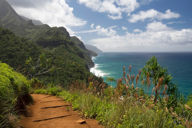
Kalalau Trail
Kauai, Hawaii
If (good) looks could kill, most wouldn’t last more than a few minutes on this dreamy 11-mile stretch of the lush Na Pali Coast on Hawaii’s Kauai Island. Instead, a few other features of this picture-perfect hike could lead to your early death. Like the narrow trail that ventures through five different Hawaiian valleys, hugging 4,000-foot-high volcanic cliffs over the Pacific Ocean. Scary, but it becomes downright horrifying by adding just a little moisture, which turns the earthy path into a very-unfun slip and slide. And the trail just so happens to be littered with waterfalls on top of three flash-flood-prone jungle rivers.
In April 2014, these floods caused 121 hikers to need to be rescued in just one day. While you’re navigating the precarious path praying for no rain, you’ll also have to mind the locals. If you make it to the end, the reward is handsome: The impossibly perfect secluded beaches of Hanakapi’ai and Kalalau. Seasoned hikers can do the trail in a day, but most will need to camp out at one of the two pre-approved campsites.
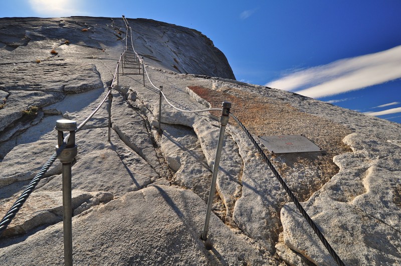
Half Dome Cable Route
Yosemite National Park, California
There are few peaks in the U.S. more iconic than Half Dome in Yosemite National Park. The Granite peak reaches nearly 5,000 feet above the valley floor and has a flat-surfaced top with views that have shown up in Ansel Adams’ artwork. For the most part, the 14-mile round-trip trail is a moderate hike — steep but not technical. It gets sketchy at the last 400 feet, where since 1919, two meager metal cables have allowed hikers to climb up to the top. No ladder. No railings. No safety equipment.
The cable route can also get crowded, despite the need for a permit (on weekends), and every year, there are rescues and sometimes deaths (the last happening in 2019). The biggest threat, park rangers say, is from quick-forming lightning storms that have the ability to fry anyone whose misfortune places them on the metal cables at the wrong time.
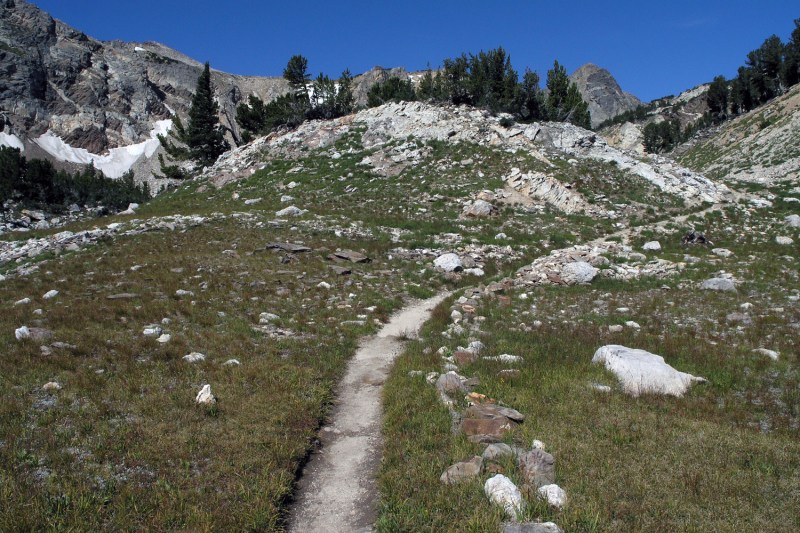
Paintbrush Canyon – Cascade Canyon Loop
Grand Teton National Park, Wyoming
The official NPS website simply lists this hike as “very strenuous.” That’s ranger speak for “most of y’all probably shouldn’t attempt this.” The landscape of Grand Teton National Park is among the most beautiful and rugged in the country. This trail is hard even relative to the park’s own standards.
It’s more than 20 miles of jaw-dropping scenery that takes hikers up Paintbrush Canyon and across Paintbrush Divide toward Lake Solitude, before dropping into Cascade Canyon. But all that beauty doesn’t come easy. The trail gains almost 4,500 feet of elevation with an average slope of 9% — all while crossing bridges, exposed roots, rocks, steps, neverending switchbacks, and a scree field that’s often full of snow late into the year.
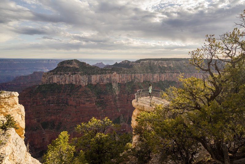
Bright Angel Trail
Grand Canyon National Park, Arizona
Take warning in the fact that the park service staffs something called Preventative Search and Rescue (PSAR) whose sole purpose is to urge the unprepared to get off the Bright Angel Trail. They also man water stations for overheated hikers on this popular 4,380-foot deep, 9.5-mile round trip rim hike in the Grand Canyon, and still there are over 200 rescues a year.
The most common things hikers forget? There’s little shade along the way, and temperatures increase as you descend into the canyon, regularly reaching the 110-degree mark. In case you miss someone from the PSAR, there are also signs in every imaginable language warning hikers of the treacherous journey ahead. Bottom line: If you must walk down the Grand Canyon, bring plenty of water, your own shade, start early, and rest often.
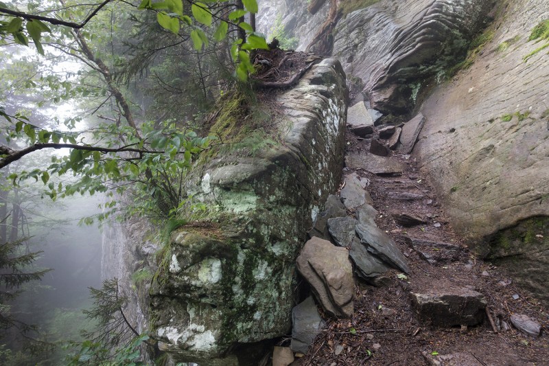
Devil’s Path
Catskills, New York
Less than a two-hour drive from Manhattan is one of the country’s most underrated treks: 25 miles of gorgeous Catskills views, waterfalls, wildlife, and a whole lot of scaling of slippery, rocky walls. It may seem quaint by Rocky Mountain standards, but the trail includes steep, vertical climbs where you’re only holding onto tree roots.
It meanders across seven peaks (including the famed Indian Head peak) at a grueling 14,000 feet in combined elevation. Taken piece by piece, the trail is moderate, but attacking it all at once can be downright deadly. Deaths and rescues are a regular part of the Devil’s Path’s landscape.
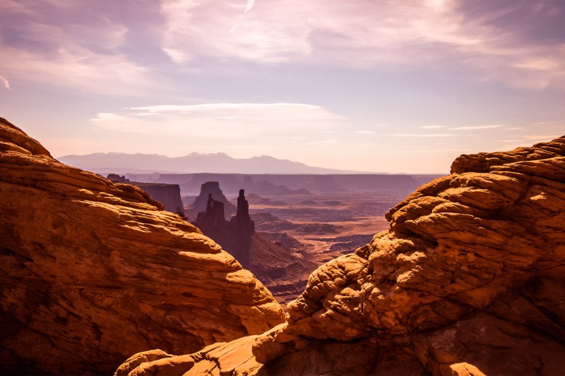
The Maze
Canyonlands, Utah
The Maze — a super-heated playground of sandstone fins — is the most inaccessible part of Canyonlands National Park in Utah. You need a high-clearance 4×4 vehicle to take you the 45 miles down a treacherous dirt path past the ranger station just to get to the trailhead. Enter without a topographical map, a GPS (and the ability to use them), and a two-way satellite messenger, and you may never find your way out of the mess of dead-end valleys.
To its credit, the National Park Service has done a good job at keeping the inexperienced out. Despite this being one of the most dangerous hikes in the country, there have been no deaths reported yet. But that could have something to do with the fact that only 1,000 or so people attempt this crazy trek every year.
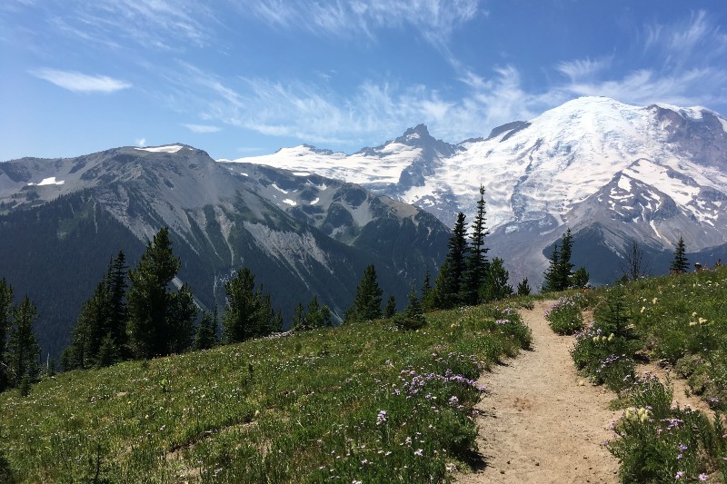
Muir Snowfield Trail
Mt. Rainier, Washington
This hike might seem easy at first, but rapidly changing weather conditions and an ice-ridden vertical climb make this one especially dangerous. Hikers begin their route on a paved trail through a summer meadow before ascending 2,800 vertical feet in 2.2 miles to get to the Muir Snowfield. Hikers should come prepared with food and proper equipment like crampons and possibly ice axes before committing to this trek, as winter weather from the Pacific Oceans comes in fast and hard at this altitude.
Hiking Project warns potential climbers that people have died on the Muir Snowfield, even in the middle of June, so you can never be too safe. The last 250 vertical feet to the summit are seemingly endless and challenging even for experienced climbers. For those that make it to the top, an unobstructed view of Mt. Rainier up close and personal awaits, complete with hanging glaciers, tall seracs, and yawning cracks.
Editors' Recommendations
- The best long-distance bike trails across the U.S.
- How being stinky when hiking in the deep woods might actually save your life
- Take a break at one of these U.S. National Parks this winter
- Dispersed camping is your way to camp for free throughout the U.S. (seriously)
- These national parks have the most gorgeous winter hiking trails


