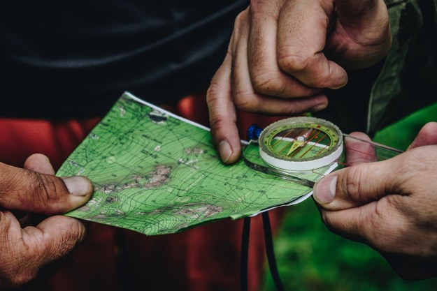
It’s time to dust off your best hiking boots and get them ready for new dirt.
Across rainforests, mountain ranges, sprawling plateaus, rivers, and valleys, the North American continent offers some of the most stunning natural geography in the world. To take in these amazing natural experiences, you can set out on weeks- or months-long journeys, but most of us don’t have the time. No need to worry because The Manual has got your back with six of the best day hikes in U.S. national parks.
So load up your pack with day hike essentials and tasty hiking snacks — hiking season is here and the trail awaits.
Jordan Pond to South Bubble Summit, Acadia National Park

Length: 3 miles
Difficulty: Moderate
There’s no better place to immerse in Maine’s majestic hardwood forest than on the trail that skirts Jordan Pond, especially in the autumn. This 3-mile trek skates along the edge of Acadia’s glacial lake before climbing to the crest of the South Bubble and rewarding visitors with phenomenal views of Pemetic Mountain and the breathtaking blue waters below. Every October, fiery fall foliage bursts forth, rewarding hikers with awesome natural vistas. After returning to the bottom, refuel with popovers and blueberry soda at Jordan Pond House, conveniently situated right inside the park.
Castle Trail/Medicine Root Loop, Badlands National Park

Length: 11 miles
Difficulty: Strenuous
Badlands is just that: A sandy scrub that leads up to an alien landscape of striated, sedimentary hills left behind by glacial flow. Take the several-hour rolling loop along the Medicine Root Trail (connecting with the Castle Trail near the Old Northeast Road), and you can find undulating prairie that offers up cactus, rattlesnake, and possible bison sightings. (Don’t get too close — the cactus and the snakes are liable to bite.) Stop along or take side trips along spur trails to take in scenic overlooks that offer South Dakota’s waving rocks along the Wall Formation. Loop back to the car and either camp under the stars or head into town to take in the ultra-touristy yet impossible-to-hate city of Wall.
And if you’re traveling to the park during summer’s peak season, be sure to hit the trails as early as possible to avoid crowds and the heat.
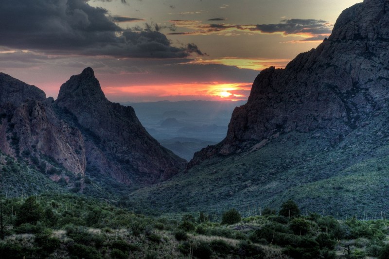
Window Trail, Big Bend National Park

Length: 5.6 miles
Difficulty: Moderate
Texas’ “Gift to the Nation,” Big Bend National Park offers over 150 miles of trails and recreational activity. Carving through the park’s Chisos Mountains is the Window Trail, which transitions from forest to canyon to expansive views of the Chihuahuan Desert below. During the summer months, it is too hot to hike at lower elevations, but the Window Trail maintains cool mountain air.
In addition to the sprawling landscape, it is not uncommon to see black bear, mountain lion, and gray fox tracks and scat along the trail. Bounding and skittering along the rocks are often Carmen Mountain white-tailed deer, rock squirrels, whiptail lizards, Spotted Towhees, Tufted Titmice, and Mexican Jays. Park at the Chisos Basin Campground to access the craggy sandstone fins of the Chisos Mountains along this well-paced trail, culminating in a mellow rock scramble up to the park’s iconic Window Formation.
This is south Texas, so summers can get hot. But, being a desert, the nights still tend to be cool, with sprawling, cloudless summer night skies awaiting those willing to brave the day’s heat.
Peek-A-Boo Loop Trail, Bryce Canyon National Park

Length: 5.2 miles
Difficulty: Strenuous
The Peek-A-Boo Loop Trail begins at Bryce Point and drops quickly to the canyon floor. The hike is challenging due to rapid elevation changes along its over 5-mile length. Believe us, though, Bryce Canyon’s natural beauty is worth the sweat. As an added bonus, you can escape the throngs of summer visitors.
In-season crowds seethe in popular national parks, so you’ll often have to endure a lot of extra leg burn to escape the crowds. The Peek-A-Boo Trail, however, skirts these packs to weave amidst thousands of finger-like, projecting hoodoos (rock spires) in the arid southern Utah geography.
Remember too, that this is a loop, and you’ll have to reascend the 1,400 feet drop down to the canyon floor.
Alum Cave Trail, Great Smoky Mountains National Park

Length: 5 miles
Difficulty: Moderate
Great Smoky Mountains National Park spreads over 522,427 acres between Tennessee and North Carolina. Choosing a place to hike here might be overwhelming, but the path up to Alum Cave contains some of the best that the Smokies has to offer — old-growth hardwood forest, rippling waterfalls, and the eerie Arch Rock tunnel that emerges at a gold-tinged overhanging cave (and a perfect place for a rest and a bite to reenergize).
As the trail climbs up Peregrine Peak, climbers can catch a heath bald full of mountain laurel and rhododendron before reaching Inspiration Point, a rocky outcrop that offers a panoramic spread of the rugged valley below and its surrounding by mountains. Turn around here to complete the 5-mile loop, or, for more fun, continue along on the trail to the summit of Mount Le Conte for sweeping vistas.
Panorama Trail, Yosemite National Park

Length: 9 miles
Difficulty: Strenuous
Yosemite National Park’s Half Dome in California is one of the country’s most incredible natural formations, a nearly 2,000-foot granite monolith rising 5,000 feet above the valley below.
As such, it’s also an incredibly popular hike, with a permit required to hike it. Although a reservation is required to drive into Yosemite National Park during peak hours from May 20 through September 30, you can find some of its best sights (including Half Dome) along less-traveled the Panorama Trail.
In a national park internationally-recognized for endless, show-stopping appeal, Yosemite’s Panorama Trail steals the show. Beginning at Glacier Point, a sweeping view overlooking the whole Yosemite Valley, the trail ventures around the roaring Illilouette Falls to pop out with a spectacular spread that includes Half Dome and Liberty Cap, a 1,700-foot granite outcropping.
Editors' Recommendations
- Don’t let the season stop you: Our top picks for the best winter hiking gear
- The 7 Best Trekking Poles for Your Upcoming Hike
- The 6 Best Headlamps for All Sorts of Adventures in 2022
- 6 Spectacular National Forests for Cross-Country Skiing
- The Best Dive Spots in the U.S. During the Winter Months